Everyone loves the alluring mix of power and beauty bestowed upon us by a waterfall, whether it is from a massive fall sounding like a jet engine or a gentle fall dripping down moss-covered rocks. Scientists have found there is a physical reaction between humans and waterfalls. A waterfall releases negative ions as the water sprays out in tiny mist droplets on our skin which we soak up as positive energy. Our production of serotonin increases once we absorb them, making us feel happier.
Waterfalls stimulate our senses. The natural shape, rocks, and foliage of each fall forms its unique structure. There is nothing like sitting before a fall, gazing on all that shapes it while listening to the water pass over. The clean organic smell of the natural environment fills our noses with smells most only enjoy occasionally in our busy lives filled with pollutants. Soaking our feet in a shallow area or even fully emerging our bodies in a deep plunge pool of granite in cold mountain water is pure heaven after a long hot hike. Without water, there is no life.
Tennessee offers many spectacular waterfalls located mainly in the eastern and middle areas of the state. They vary dramatically in shape and height but are all amazing works of nature. The following map contains twenty of the must-see falls Tennessee has to offer.

Twenty must-see waterfalls in Tennessee
Story by: Lori Prater
“A river cuts through a rock, not because of its power
but because of its persistence.”
~ Jim Watkins
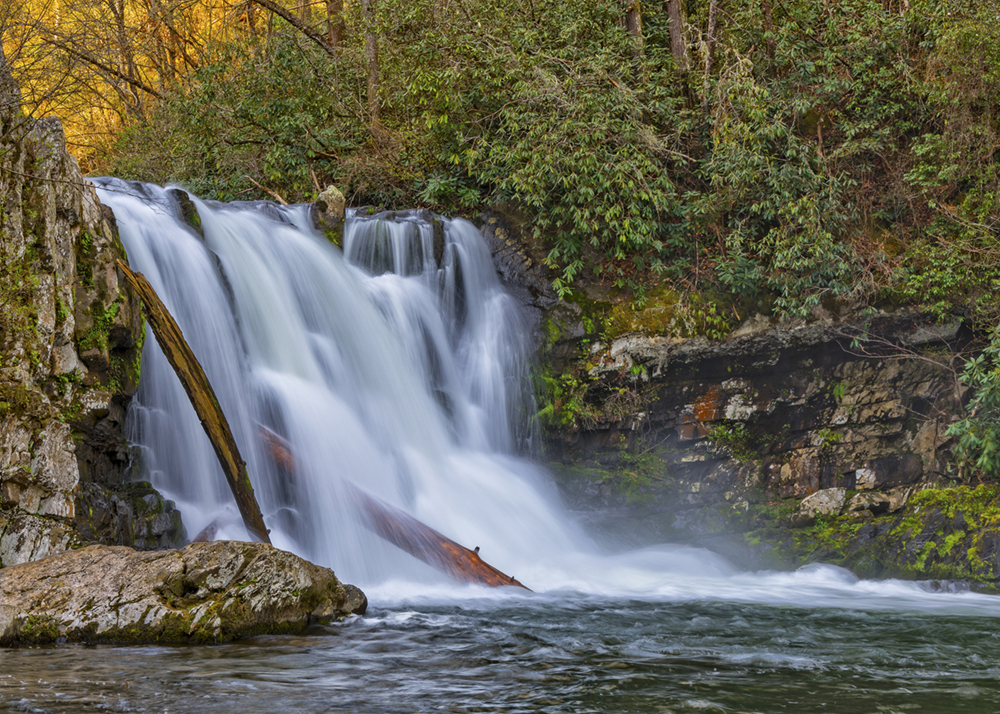
Abrams Falls
Near Cades Cove and located in the Great Smoky Mountains National Park, Abrams Falls is 20-feet high with a vast amount of water tumbling over. There is a deep and wide plunge pool. Many people swim in the pool; however, the park warns that there are strong currents and undertows, making it extremely dangerous. In addition, black bears and otters may be seen in the area. Between 1988 and 1990, state biologists released 133 otters here in an effort to bring the species back to the park since they were hunted to extinction. Interestingly, the Cherokee word for the Cades Cove area, “Tsiyahi,” means “place of the otter.”
The hike is 5.2-miles roundtrip over moderate to difficult terrain taking 3-4 hours. The trailhead is located off the Cades Cove Loop Road and is well marked.
Click for more information
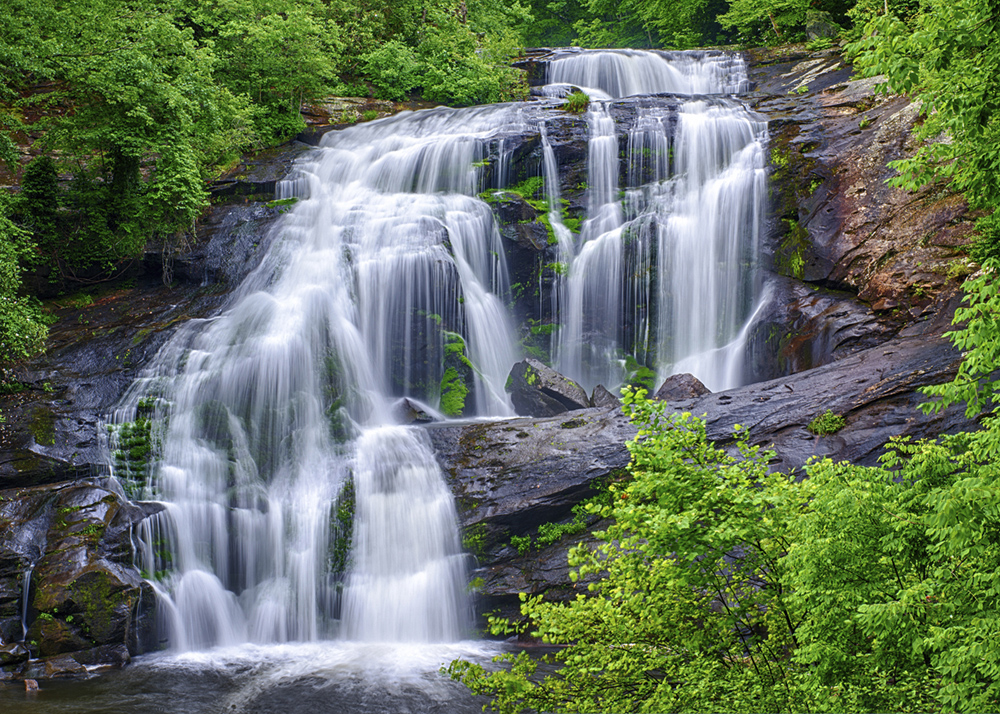
Bald River Falls
Located in Monroe County, Bald River Falls is a part of the Cherokee National Forest and a tributary of the Tellico River. The height is 90-feet and easily one of the most impressive, scenic waterfalls, fed by a short but powerful river making for a robust waterfall. It provides outstanding photographic opportunities.
The waterfall is accessible by Tellico River Road (Forest Service Road 210) or by hiking the Bald River Falls Trail. The hike is 8.2-miles of moderate difficulty roundtrip taking 2-4 hours.
Click for more information
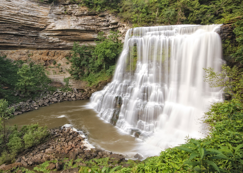
Burgess Falls
Burgess Falls is a 136-foot waterfall plunging into a vast limestone canyon on the Falling Water River in Sparta. There are three other waterfalls and several cascades in the nearby area. Protruding rocks halfway down break the flow of water and spread a mist around the base of the falls. The bluffs rise on each side of the gorge framing the falls in rough gray rock.
A 3-mile roundtrip hike leads to the top of the waterfall along the River Trail off Service Road Loop. A steep trail leads to the edge of the falls, where a stairway leads into the gorge. The lower area of Burgess Falls is also accessible by water: kayak, jet ski, or boat from Center Hill Lake.
Click for more information
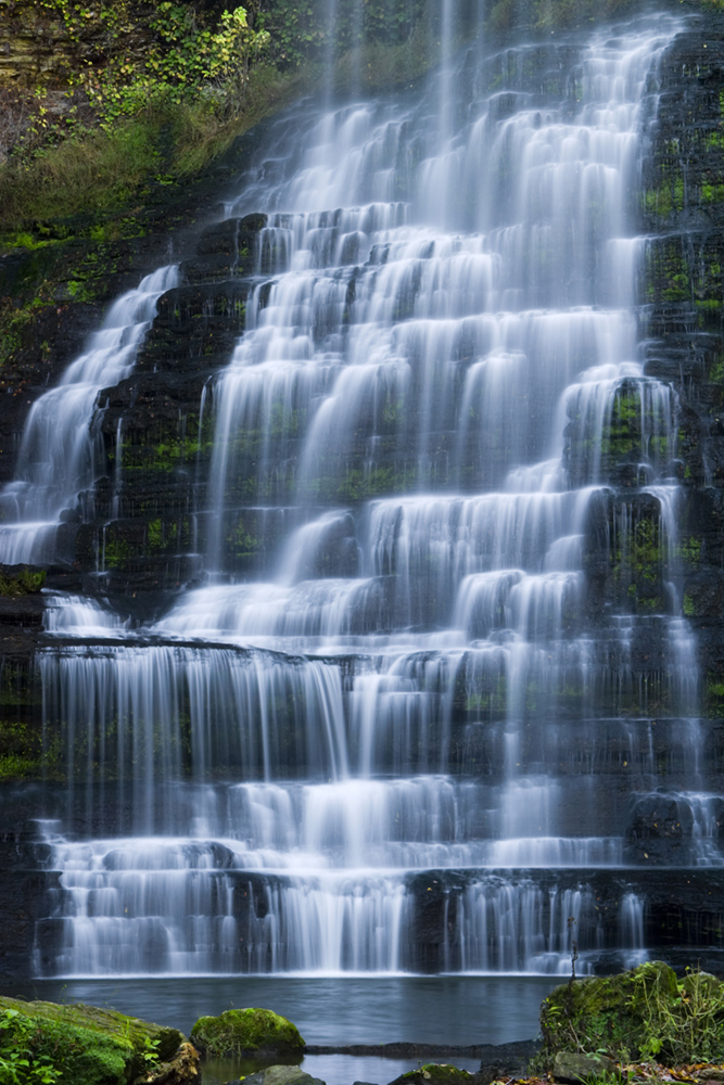
Carmac Falls
Carmac Falls is a beautiful, privately-owned 90-foot-tall waterfall located on the property of Evins Mill Resort in Smithville. You can visit the falls by booking a room or buying a day trip pass.
The resort offers two trails to the falls. A mile-long trail loop on the north end, which is difficult to traverse, leads you to the overlook of the falls. The south trail is 1.5-miles roundtrip of moderate difficulty and takes you to the base of the falls.
Cummins Falls
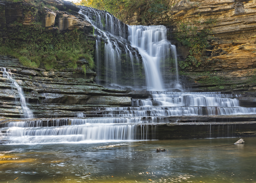
Located in the Cordell Hull Watershed, the area has been a scenic spot and swimming hole for residents of Jackson and Putnam counties for more than 100 years. Cummins Falls is Tennessee’s eighth largest waterfall in volume of water and is 75 feet high. There is a large plunge pool to cool off in after the hike.
A state Gorge Access Permit is required to visit the waterfall base and is only accessible on fair-weather days because it is prone to flash flooding. It is a very strenuous hike and not appropriate for children under five. It is a 3-mile roundtrip hike with steep, uneven terrain requiring crossing streams, slippery boulders, and other obstacles.
Click for more information
Fall Creek Falls
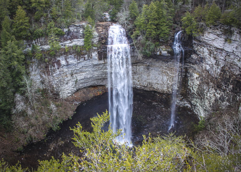
Fall Creek Falls, located within a sprawling 29,800-acre park of the same name, is located at the eastern tip of the rugged Cumberland Plateau. The waterfall is a 256-feet drop which is one of the highest falls in the eastern United States.
It is an easy walk along a short trail to the waterfall, taking a couple of hours to enjoy the hike and the falls. The park has other waterfalls, cascades, gorges, and stands of virgin hardwoods.
Click for more information
Foster Falls
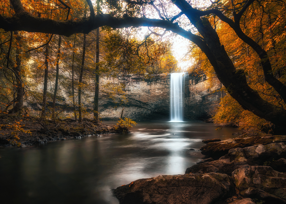
Foster Falls is a 60-foot fall that cascades into a deep pool beneath. It is located in the Foster Falls Recreation Area inside the South Cumberland State Park in Sequatchie, TN, 30 minutes from Chattanooga. Following the directions to the falls, the hike reaches a large observation platform where you can see the massive waterfall. Next, the trail descends a series of wooden and rock stairs, dropping over 100 feet into the valley near the falls. Fiery Gizzard Creek has an enormous suspension bridge. From the bridge, views of Foster Falls emerge. Seventy-five yards away, a clearing on the opposite side of the bridge provides a spectacular view of the waterfall. The plunge pool often becomes a popular spot for cooling off in the water in the summer months.
The hike begins at a very accessible trailhead. It is a 2-mile loop trail that is moderately difficult.
Greeter Falls
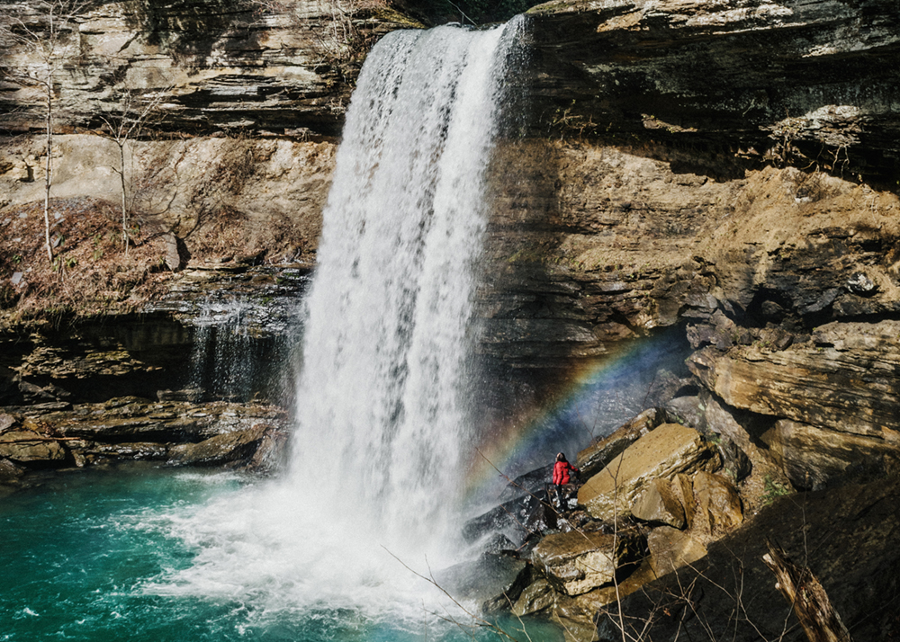
Greeter Falls are made up of two separate falls. The upper falls are 15-feet tall, and the lower falls drop 50-feet into an ideal swimming hole. However, the upper falls cascade into a shallow pool which sweeps over to the bigger fall and is a danger for swimming. The falls are located in the Savage Gulf State Natural Area.
Greeter Falls is located near Altamont is a 3.2-mile roundtrip hike from a well-marked trailhead beginning at a sizable parking area. It is reasonably easy to hike with a few rocky root bare areas that are a little tricky to cross. The end of the trail leads to a spiral staircase that takes you to the lower falls.
Click for more information
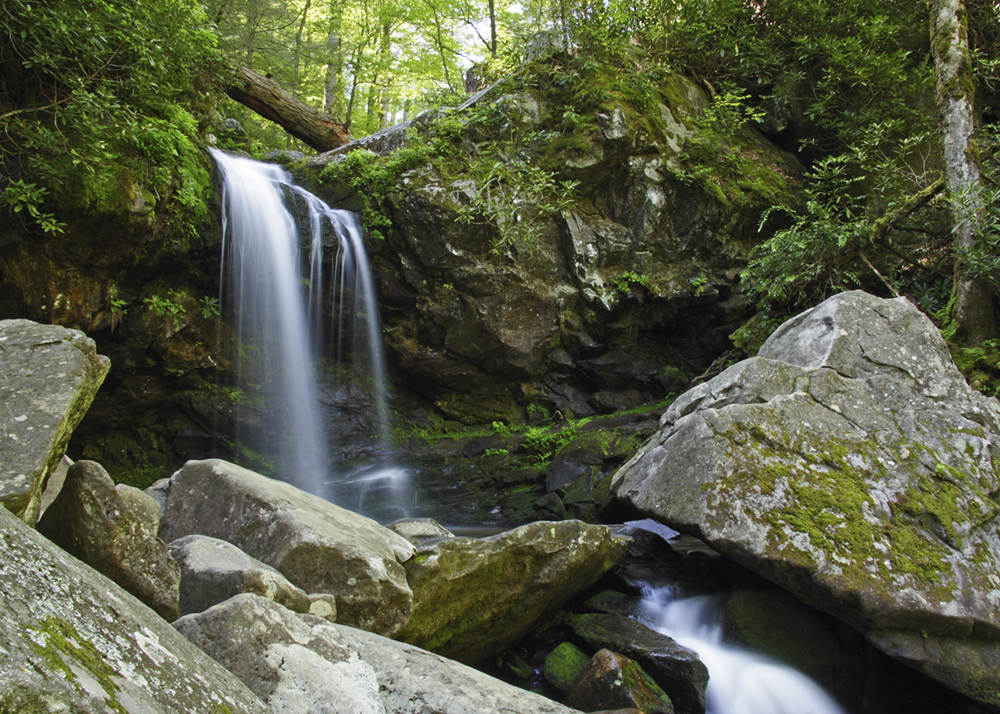
Grotto Falls
Located on the Trillium Gap Trail off the Roaring Fork Motor Trail, the hike meanders through an old-growth hemlock forest and runs behind the 25-foot-high waterfall. The cool, moist environment near the falls is ideal for salamanders and summer hikers. In addition, black bears are active in this area.
There is a 2.6-mile roundtrip moderate difficulty hike taking approximately 2-3 hours there and back.
Click for more information
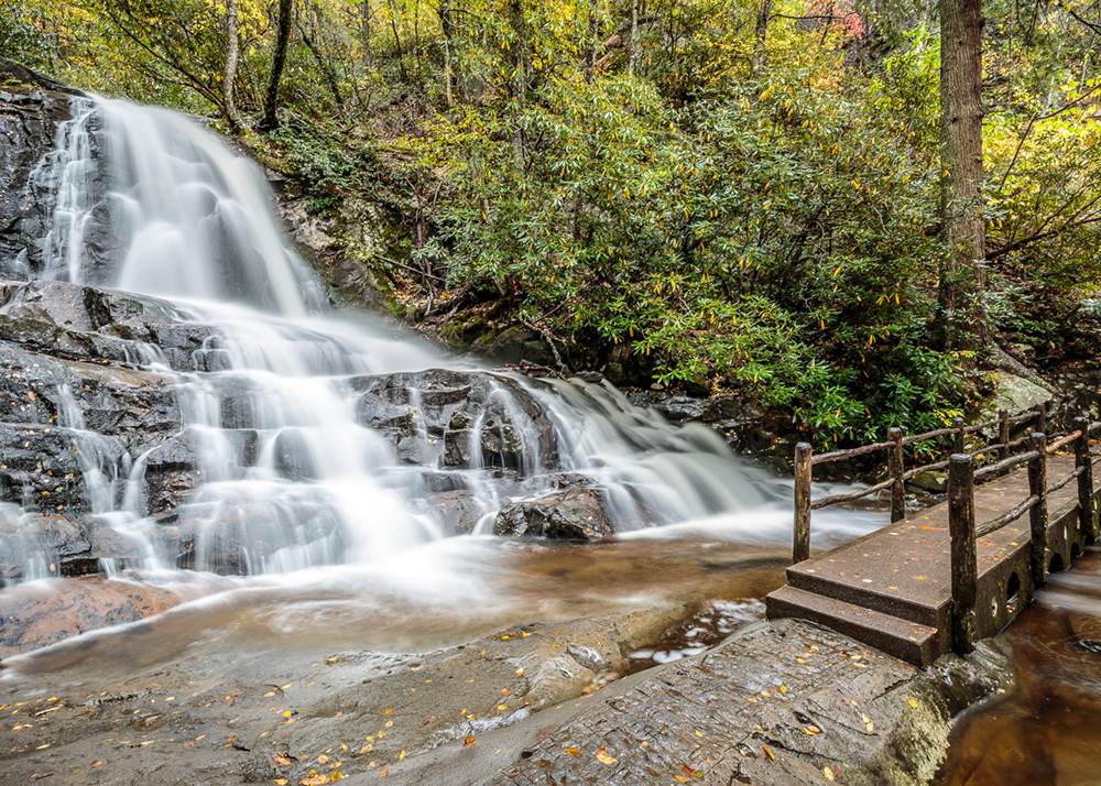
Laurel Falls
Laurel Falls drops 80-feet and is located in the Great Smoky Mountain National Park. The waterfall is divided into two sections which are separated by a wooden bridge that crosses the stream. It is named after the abundant mountain laurel that grows throughout the park. Black bears are often active in this area.
The trail is 2.6 miles roundtrip along a paved path. Although it is clean of rocky or harsh terrain, it is rated as moderately difficult due to the steep incline, which is slippery when wet; plan for a two-hour trip to and from the falls.
Click for more information
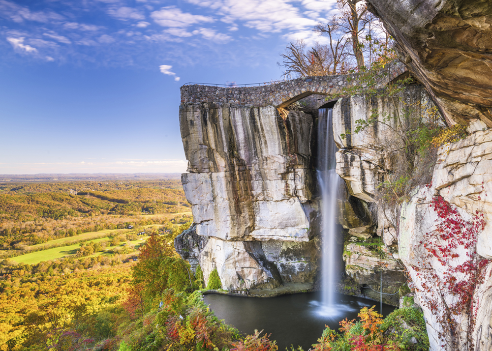
Lovers Leap Falls
Lover’s Leap Falls is located within the Rock City attraction just outside of Chattanooga at the top of Lookout Mountain. It is 140-feet high. At the top, visitors can see seven states on a clear day. It’s named after a Cherokee legend where two star-crossed lovers from warring tribes have a tragic end.
You can hike through Rock City Gaden and see many scenic overlooks; however, the falls are not accessible from below and can only be seen from afar or from the lookout point above. The hike is less than a mile, along with an easy trail taking you through various rock formations, a hanging bridge, and caverns.
Click for more information
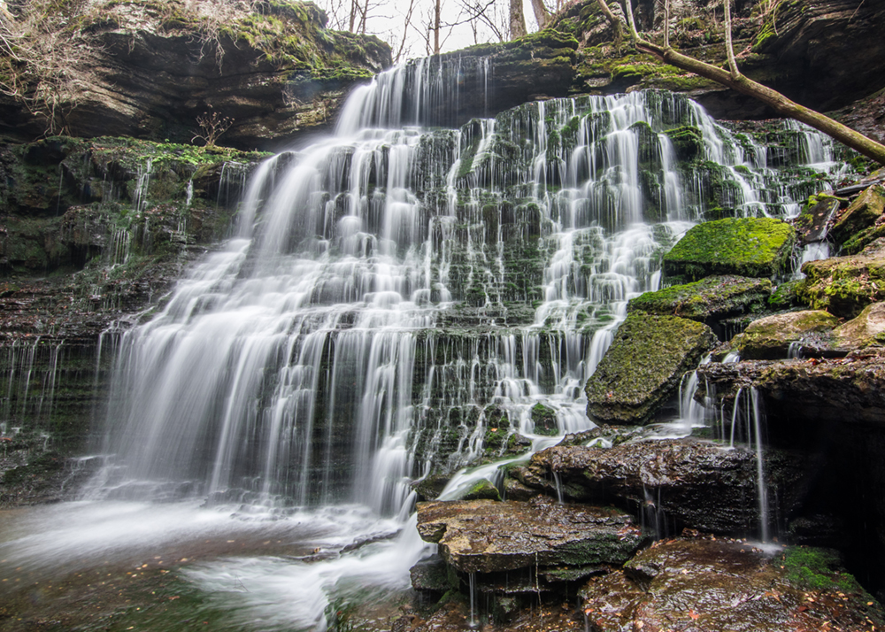
Machine Falls
Machine Falls is located in the Short Springs 420-acre natural area in Coffee County, approximately three and a half miles northeast of Tullahoma. The waterfall rests in an area between the Highland Rim and Central Basin geological area. It is both 60-feet tall and across. Along the hike, there are springs, cascades, and lush forests. It boasts a vast biological diversity. The waterfall is owned by the State of Tennessee, TVA, and the City of Tullahoma.
The waterfall reached via a 1.6-mile, moderately difficult hike. Along the hike are other small waterfalls, creeks, lush greenery, and wildlife.
Click for more information
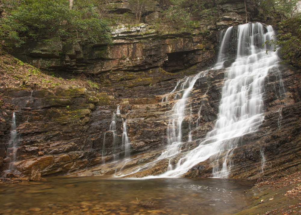
Margarette Falls
Margarette Falls is a 60-foot-high, fan-shaped waterfall located in the lush Cherokee National Forest. The trail starts at the Margaret Falls Parking Area, passes three wooden bridges, and continues to a platform where there are picturesque views.
The first .5-mile section of this trail is an easy hike on a closed Forest Service road. The trail forks shortly after leaving the road, where you will bear left and travel along Dry Creek 1.9 miles to the waterfall. This section of the trail is moderately difficult and crosses the stream several times.
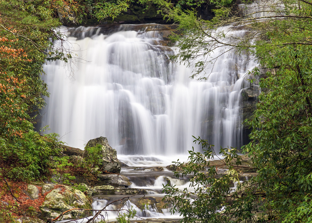
Meigs Falls
This 30-foot waterfall can be seen from a turnout on Little River Road between Cades Cove and Sugarlands Visitor Center. Trees in the summertime partially obstruct the view; otherwise, the view is good, if not great.
No hike is required to see the falls; however, if you want a closer view, you will need to cross slippery rocks, roots and wade across the stream.
Click for more information
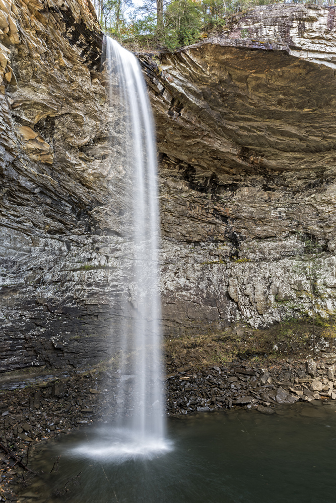
Ozone Falls
Ozone Falls is located in a 43-acre natural area in Cumberland County near interstate I-40. It is a dramatic 110-foot drop into a rocky pool that not far downstream disappears underground. The picturesque falls were used as a backdrop for scenes in the Jungle Book movie. It is named after the misty water created by the unobstructed plunge to the rocks below reminiscent of ozone.
The Cumberland Trail provides access to both the top and bottom of the falls. It is a .6-mile roundtrip hike to the falls of moderate difficulty. The trailhead is near the town of Crab Orchard.
Click for more information
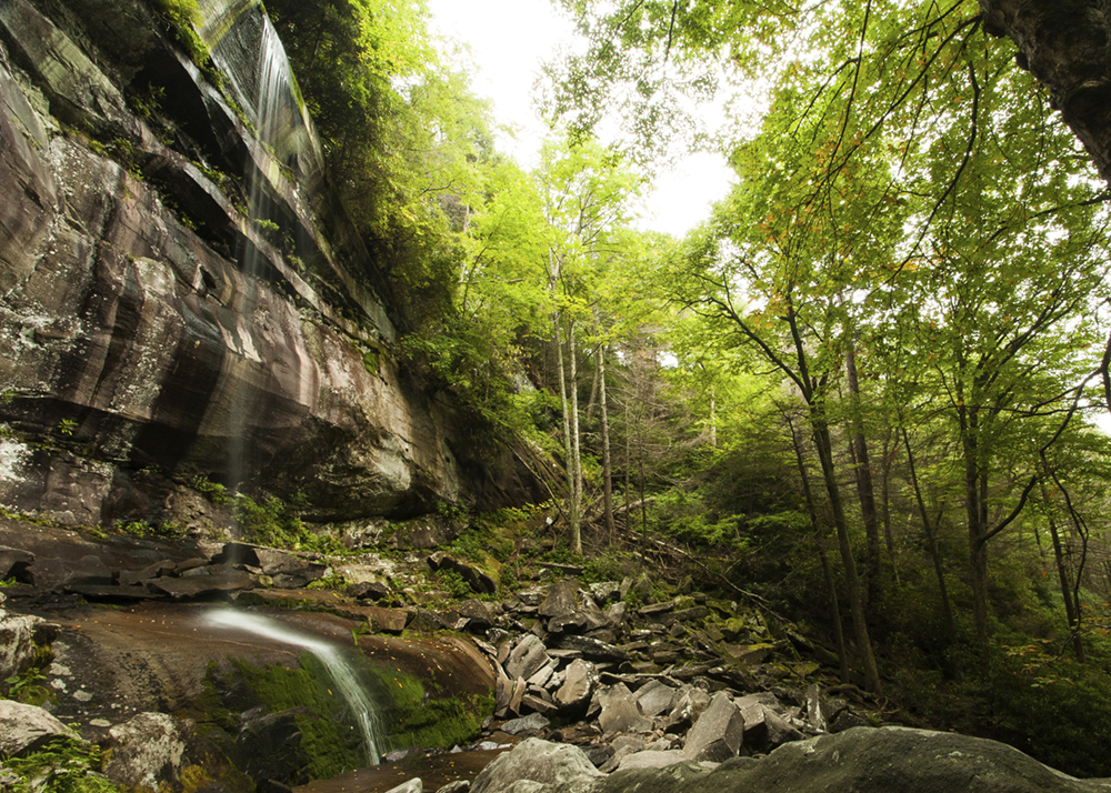
Rainbow Falls
Rainbow Falls is 80-feet tall and is spectacular after prolonged rain; it is the highest single-drop waterfall in the Great Smoky Mountains National Park. Its name comes from the rainbows seen on the mist when the sun strikes the water.
There is a strenuous 5.4-mile roundtrip hike with rocky slopes taking you up 1,500 feet over the middle section over 2.7 miles. Plan four hours for the hike.
Click for more information
Ruby Falls
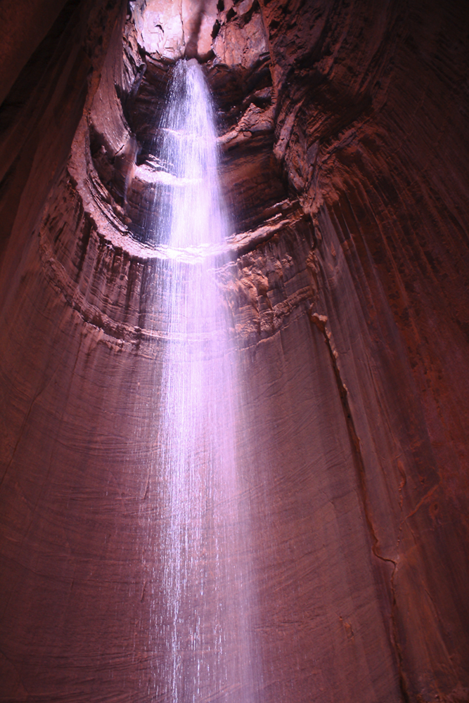
At a drop of 145-feet, Ruby Falls is the highest and deepest underground waterfall in the United States. Leo Lambert discovered Ruby Falls in 1928 while on an expedition into the caves beneath Lookout Mountain in Chattanooga. He named the falls after his wife Ruby and opened them to the public in 1929.
To reach the falls, visit the attraction located on the South Scenic Highway just outside of Chattanooga, TN. Then, descend 260-feet into the cave via a glass-front elevator into the mountain and explore the cavern trail to the falls.
Click for more information
Spruce Flats Falls
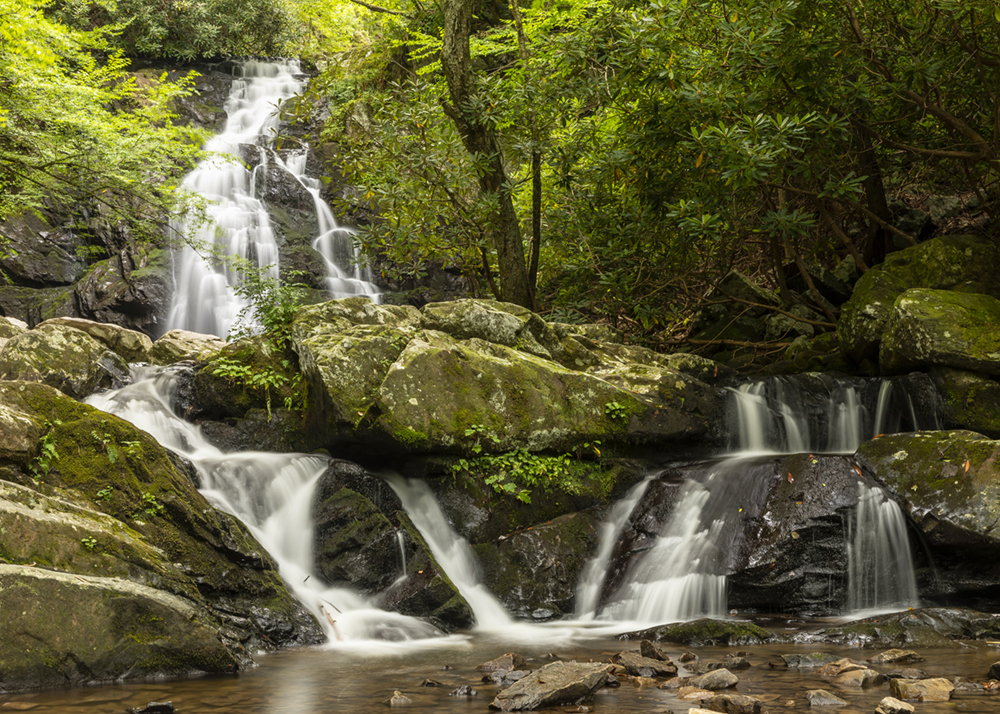
Spruce Flats Falls tumbles down the rocky hill in four separate tiers, with a total drop of roughly 30 feet. The trail to the waterfall begins at the Great Smoky Mountains Institute in Tremont. Roughly 20 yards from the trailhead, hikers will reach the Buckeye Trail junction. To continue towards Spruce Flats Falls, turn right onto the Buckeye Trail. The waterfall does not appear on the official park map. However, despite being an unofficial trail, the route is well defined and very easy to follow.
The hike is 1.4 miles and is of easy difficulty.
Click for more information
Twin Falls
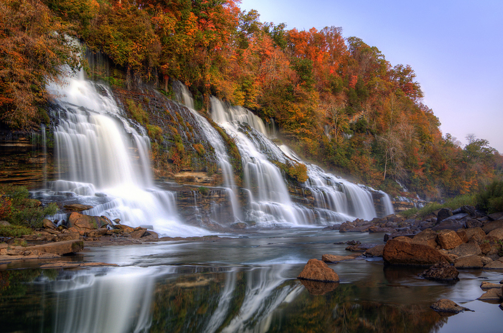
Twin Falls is 80-feet tall and located in the 883-acre Rock Island State Park between Sparta and McMinnville south of Smithville. It is named for two mainstream waters, the Collins and Caney Fork rivers. The waterfall spills down from a cavern. It was created by the Great Falls Dam, which caused the Collins River to rise. The rising waters began seeping into caverns on Rock Island’s south shore and exiting at the falls on the north shore. The falls are 40-feet below the rim of the Caney Fork Gorge.
Upon entering Rock Island State Park from the east, the parking area for this trail is located right after the old cotton mill. At the beginning of the trail are steep, slippery stairs. Once down the stairs, follow the half-mile trail along the river. Stay on the right side of the river as the falls are on the left, and the river becomes difficult or impossible to cross. In addition, there are many rocks and boulders to climb over, making this short but rough hike a high difficulty level.
Click for more information
Virgin Falls
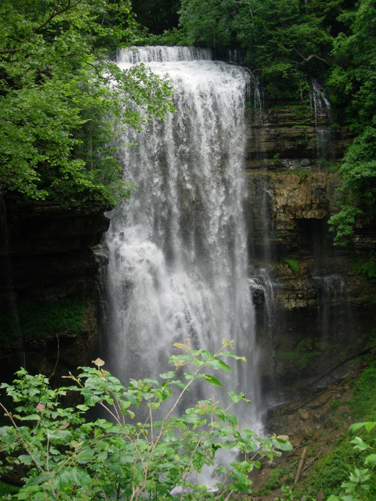
Located in the 1,157-acre natural area in White County, Virgin Falls is created by an underground stream that drops over a 110-ft high cliff before disappearing into another cave at the bottom of the sink. The trail passes by small rock houses, boulder fields, sinks, caves, and waterfalls on route to Virgin Falls, where the trail ends.
A 9-mile roundtrip hike with a strenuous 900-foot elevation drop of rocky terrain will take approximately 7 hours there and back. The area has unique geological features and several other waterfalls, including Big Laurel, Sheep Cave Falls, and Big Branch Falls.
Click for more information
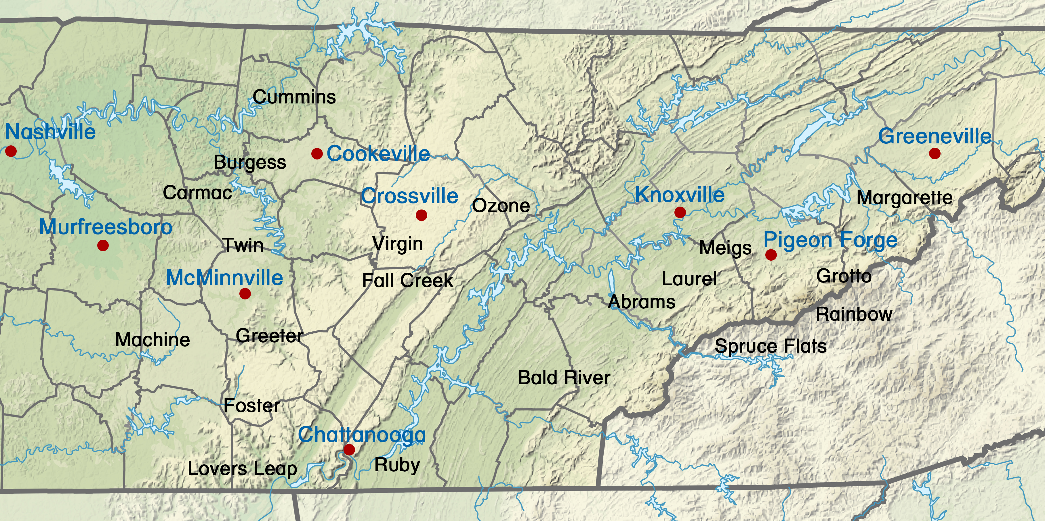
Click on the number icon to learn about each one.
(Photo courtesy of: SANtosito, CC BY-SA 4.0 https://creativecommons.org/licenses/by-sa/4.0,
via Wikimedia Commons modified with Waterfall and City names and locations.)
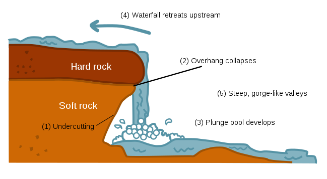
A waterfall is created at a point in a river where water flows over a steep vertical drop or over a series of drops at an angle of approximately no more than 25%. The most common way a waterfall is formed is when a river courses over a top layer of resistant bedrock before falling onto softer rocks. The softer rock erodes much faster than, the harder rock. Waterfalls are more often found in the higher areas of mountains, where lakes flow into valleys at lower elevations. Sometimes waterfalls are created by fault lines along the edge of a glacial trough, or where two streams join, and one is flowing faster than the other.
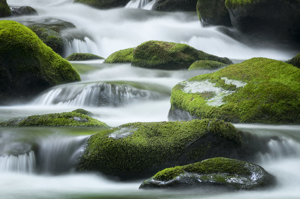
Currents near waterfalls can be drowning machines. Waterfalls are beautiful scenic vistas but can also be very deadly. Waterfalls can be enjoyed safely as long as you don’t put yourself into a dangerous situation, and most accidents involving waterfalls could have been prevented. Situational awareness can help keep you safe.
Things to keep in mind:
- Never climb waterfalls or go near the top area.
- Never jump into plunge pools. Logs or rocks may be hidden under the surface, and the sudden impact of the extremely cold water can cause temporary paralysis that could lead to drowning. In addition, plunge pools have churning hydraulic currents that can trap you underwater.
- Stay off of or use extreme caution on the slick rock surfaces that are wet or moss-covered.
- It would be best if you stayed on the trail leading to the fall. Watch your step and wear ankle-supporting shoes (not flip flops or sandals).
- When in parks and uninhabited areas, you can not count on having cell service. Instead, be prepared for the weather, keeping in mind that rain upstream can quickly cause flash flooding.
- Extreme caution should be taken with children and pets.
- Watch taking selfies. An alarming number of people have been killed or seriously injured when taking a selfie by stepping off an edge.
- Keep in mind that when in nature, there are other dangers like bears, poisonous snakes, bees, and poisonous plants.
Click on the thumbnail
to learn about each one.

Abrams Falls
Near Cades Cove and located in the Great Smoky Mountains National Park, Abrams Falls is 20-feet high with a vast amount of water tumbling over. There is a deep and wide plunge pool. Many people swim in the pool; however, the park warns that there are strong currents and undertows, making it extremely dangerous. In addition, black bears and otters may be seen in the area. Between 1988 and 1990, state biologists released 133 otters here in an effort to bring the species back to the park since they were hunted to extinction. Interestingly, the Cherokee word for the Cades Cove area, “Tsiyahi,” means “place of the otter.”
The hike is 5.2-miles roundtrip over moderate to difficult terrain taking 3-4 hours. The trailhead is located off the Cades Cove Loop Road and is well marked.
Click for more information

Bald River Falls
Located in Monroe County, Bald River Falls is a part of the Cherokee National Forest and a tributary of the Tellico River. The height is 90-feet and easily one of the most impressive, scenic waterfalls, fed by a short but powerful river making for a robust waterfall. It provides outstanding photographic opportunities.
The waterfall is accessible by Tellico River Road (Forest Service Road 210) or by hiking the Bald River Falls Trail. The hike is 8.2-miles of moderate difficulty roundtrip taking 2-4 hours.
Click for more information

Burgess Falls
Burgess Falls is a 136-foot waterfall plunging into a vast limestone canyon on the Falling Water River in Sparta. There are three other waterfalls and several cascades in the nearby area. Protruding rocks halfway down break the flow of water and spread a mist around the base of the falls. The bluffs rise on each side of the gorge framing the falls in rough gray rock.
A 3-mile roundtrip hike leads to the top of the waterfall along the River Trail off Service Road Loop. A steep trail leads to the edge of the falls, where a stairway leads into the gorge. The lower area of Burgess Falls is also accessible by water: kayak, jet ski, or boat from Center Hill Lake.
Click for more information

Carmac Falls
Carmac Falls is a beautiful, privately-owned 90-foot-tall waterfall located on the property of Evins Mill Resort in Smithville. You can visit the falls by booking a room or buying a day trip pass.
The resort offers two trails to the falls. A mile-long trail loop on the north end, which is difficult to traverse, leads you to the overlook of the falls. The south trail is 1.5-miles roundtrip of moderate difficulty and takes you to the base of the falls.

Cummins Falls
Located in the Cordell Hull Watershed, the area has been a scenic spot and swimming hole for residents of Jackson and Putnam counties for more than 100 years. Cummins Falls is Tennessee’s eighth largest waterfall in volume of water and is 75 feet high. There is a large plunge pool to cool off in after the hike.
A state Gorge Access Permit is required to visit the waterfall base and is only accessible on fair-weather days because it is prone to flash flooding. It is a very strenuous hike and not appropriate for children under five. It is a 3-mile roundtrip hike with steep, uneven terrain requiring crossing streams, slippery boulders, and other obstacles.
Click for more information

Fall Creek Falls
Fall Creek Falls, located within a sprawling 29,800-acre park of the same name, is located at the eastern tip of the rugged Cumberland Plateau. The waterfall is a 256-feet drop which is one of the highest falls in the eastern United States.
It is an easy walk along a short trail to the waterfall, taking a couple of hours to enjoy the hike and the falls. The park has other waterfalls, cascades, gorges, and stands of virgin hardwoods.
Click for more information

Foster Falls
Foster Falls is a 60-foot fall that cascades into a deep pool beneath. It is located in the Foster Falls Recreation Area inside the South Cumberland State Park in Sequatchie, TN, 30 minutes from Chattanooga. Following the directions to the falls, the hike reaches a large observation platform where you can see the massive waterfall. Next, the trail descends a series of wooden and rock stairs, dropping over 100 feet into the valley near the falls. Fiery Gizzard Creek has an enormous suspension bridge. From the bridge, views of Foster Falls emerge. Seventy-five yards away, a clearing on the opposite side of the bridge provides a spectacular view of the waterfall. The plunge pool often becomes a popular spot for cooling off in the water in the summer months.
The hike begins at a very accessible trailhead. It is a 2-mile loop trail that is moderately difficult.

Greeter Falls
Greeter Falls are made up of two separate falls. The upper falls are 15-feet tall, and the lower falls drop 50-feet into an ideal swimming hole. However, the upper falls cascade into a shallow pool which sweeps over to the bigger fall and is a danger for swimming. The falls are located in the Savage Gulf State Natural Area.
Greeter Falls is located near Altamont is a 3.2-mile roundtrip hike from a well-marked trailhead beginning at a sizable parking area. It is reasonably easy to hike with a few rocky root bare areas that are a little tricky to cross. The end of the trail leads to a spiral staircase that takes you to the lower falls.
Click for more information

Grotto Falls
Located on the Trillium Gap Trail off the Roaring Fork Motor Trail, the hike meanders through an old-growth hemlock forest and runs behind the 25-foot-high waterfall. The cool, moist environment near the falls is ideal for salamanders and summer hikers. In addition, black bears are active in this area.
There is a 2.6-mile roundtrip moderate difficulty hike taking approximately 2-3 hours there and back.
Click for more information

Laurel Falls
Laurel Falls drops 80-feet and is located in the Great Smoky Mountain National Park. The waterfall is divided into two sections which are separated by a wooden bridge that crosses the stream. It is named after the abundant mountain laurel that grows throughout the park. Black bears are often active in this area.
The trail is 2.6 miles roundtrip along a paved path. Although it is clean of rocky or harsh terrain, it is rated as moderately difficult due to the steep incline, which is slippery when wet; plan for a two-hour trip to and from the falls.
Click for more information

Lovers Leap Falls
Lover’s Leap Falls is located within the Rock City attraction just outside of Chattanooga at the top of Lookout Mountain. It is 140-feet high. At the top, visitors can see seven states on a clear day. It’s named after a Cherokee legend where two star-crossed lovers from warring tribes have a tragic end.
You can hike through Rock City Gaden and see many scenic overlooks; however, the falls are not accessible from below and can only be seen from afar or from the lookout point above. The hike is less than a mile, along with an easy trail taking you through various rock formations, a hanging bridge, and caverns.
Click for more information

Machine Falls
Machine Falls is located in the Short Springs 420-acre natural area in Coffee County, approximately three and a half miles northeast of Tullahoma. The waterfall rests in an area between the Highland Rim and Central Basin geological area. It is both 60-feet tall and across. Along the hike, there are springs, cascades, and lush forests. It boasts a vast biological diversity. The waterfall is owned by the State of Tennessee, TVA, and the City of Tullahoma.
The waterfall reached via a 1.6-mile, moderately difficult hike. Along the hike are other small waterfalls, creeks, lush greenery, and wildlife.
Click for more information

Margarette Falls
Margarette Falls is a 60-foot-high, fan-shaped waterfall located in the lush Cherokee National Forest. The trail starts at the Margaret Falls Parking Area, passes three wooden bridges, and continues to a platform where there are picturesque views.
The first .5-mile section of this trail is an easy hike on a closed Forest Service road. The trail forks shortly after leaving the road, where you will bear left and travel along Dry Creek 1.9 miles to the waterfall. This section of the trail is moderately difficult and crosses the stream several times.

Meigs Falls
This 30-foot waterfall can be seen from a turnout on Little River Road between Cades Cove and Sugarlands Visitor Center. Trees in the summertime partially obstruct the view; otherwise, the view is good, if not great.
No hike is required to see the falls; however, if you want a closer view, you will need to cross slippery rocks, roots and wade across the stream.
Click for more information

Ozone Falls
Ozone Falls is located in a 43-acre natural area in Cumberland County near interstate I-40. It is a dramatic 110-foot drop into a rocky pool that not far downstream disappears underground. The picturesque falls were used as a backdrop for scenes in the Jungle Book movie. It is named after the misty water created by the unobstructed plunge to the rocks below reminiscent of ozone.
The Cumberland Trail provides access to both the top and bottom of the falls. It is a .6-mile roundtrip hike to the falls of moderate difficulty. The trailhead is near the town of Crab Orchard.
Click for more information

Rainbow Falls
Rainbow Falls is 80-feet tall and is spectacular after prolonged rain; it is the highest single-drop waterfall in the Great Smoky Mountains National Park. Its name comes from the rainbows seen on the mist when the sun strikes the water.
There is a strenuous 5.4-mile roundtrip hike with rocky slopes taking you up 1,500 feet over the middle section over 2.7 miles. Plan four hours for the hike.
Click for more information

Ruby Falls
At a drop of 145-feet, Ruby Falls is the highest and deepest underground waterfall in the United States. Leo Lambert discovered Ruby Falls in 1928 while on an expedition into the caves beneath Lookout Mountain in Chattanooga. He named the falls after his wife Ruby and opened them to the public in 1929.
To reach the falls, visit the attraction located on the South Scenic Highway just outside of Chattanooga, TN. Then, descend 260-feet into the cave via a glass-front elevator into the mountain and explore the cavern trail to the falls.
Click for more information

Spruce Flats Falls
Spruce Flats Falls tumbles down the rocky hill in four separate tiers, with a total drop of roughly 30 feet. The trail to the waterfall begins at the Great Smoky Mountains Institute in Tremont. Roughly 20 yards from the trailhead, hikers will reach the Buckeye Trail junction. To continue towards Spruce Flats Falls, turn right onto the Buckeye Trail. The waterfall does not appear on the official park map. However, despite being an unofficial trail, the route is well defined and very easy to follow.
The hike is 1.4 miles and is of easy difficulty.
Click for more information

Twin Falls
Twin Falls is 80-feet tall and located in the 883-acre Rock Island State Park between Sparta and McMinnville south of Smithville. It is named for two mainstream waters, the Collins and Caney Fork rivers. The waterfall spills down from a cavern. It was created by the Great Falls Dam, which caused the Collins River to rise. The rising waters began seeping into caverns on Rock Island’s south shore and exiting at the falls on the north shore. The falls are 40-feet below the rim of the Caney Fork Gorge.
Upon entering Rock Island State Park from the east, the parking area for this trail is located right after the old cotton mill. At the beginning of the trail are steep, slippery stairs. Once down the stairs, follow the half-mile trail along the river. Stay on the right side of the river as the falls are on the left, and the river becomes difficult or impossible to cross. In addition, there are many rocks and boulders to climb over, making this short but rough hike a high difficulty level.
Click for more information

Virgin Falls
Located in the 1,157-acre natural area in White County, Virgin Falls is created by an underground stream that drops over a 110-ft high cliff before disappearing into another cave at the bottom of the sink. The trail passes by small rock houses, boulder fields, sinks, caves, and waterfalls on route to Virgin Falls, where the trail ends.
A 9-mile roundtrip hike with a strenuous 900-foot elevation drop of rocky terrain will take approximately 7 hours there and back. The area has unique geological features and several other waterfalls, including Big Laurel, Sheep Cave Falls, and Big Branch Falls.
Click for more information


